
The Estate in Transition
Parker's Corner
The Parker’s Corner area of the time is shown below. In the bottom right-hand corner is Cranemoor Pond and near it (31) the lodge just inside the park at the junction of Ridgeway Lane (Bostock Lane), Blyth’s Hill and its new extension back to the Bath Road. This is a new addition since 1762. The other houses between the junction and what was probably the original Parker’s Corner are shown much as in 1762 but the large block of four seems only to have two tenants, the other two houses indicated “E” and “F” though the meaning of that is unknown. Number 30 is occupied by John and Hannah Horne with their five children and 29 by George Harper (?) and Lucy. There is a pencil entry that looks like “Robert Horne” and “2 children” with some other indistinct writing. At 28 are Daniel and Mary Mildenhall with their “3 little children” and at 27 we have Smith crossed through with Henward inserted. Thomas and Elizabeth Cox are at 25 and Welch at 26. John Welch owned the house and some land nearby in 1844, though both were rented out then, and this may have been part of Parker’s Farm at the time of this map.
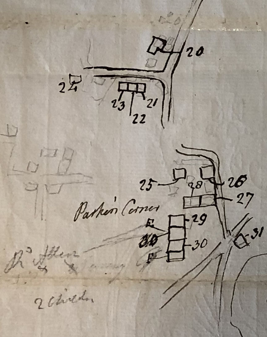
Further up the hill, on the road running across the base of the slope is a single block of three houses (21-23) home to Cox, Wells and Nash, the latter crossed through and something indistinct (Harman?) inserted. In 1762 there were two other buildings here but they may have been barns or sheds and there are some other buildings in pencil here. At the end of the track as shown, though it actually continues into the wood, is what we know to have been called Blyth’s Cottage (24), but now home to John and Thomas Knight.
Further up the hill again is a single house (20), occupied initially by Povey but then by Mildenhall and also, apparently, James Woodley. Whether these last two were consecutively or concurrently is not known. Again there are buildings shown in pencil here, which may be barns and sheds accounting for the extra ones shown in 1762.
In a separate pencil sketch is apparently a whole complex of roads and buildings. From the layout of the roads this looks as though it may be Mareridge Farm.
Neither Bostock Cottages nor Bostock Lodges are shown, though the cottages are seen in the 1811 enclosure plan for Sulhamstead. The lodges were built between the closure of the turnpike in 1826 and the drawing of the Englefield enclosure map in 1829. They were probably built in about 1827 following the court case brought by Richard Benyon in the summer of 1826 against defendants Welch and another for breaking down of gates and fences at this point in order to continue use of the closed turnpike
Common Hill
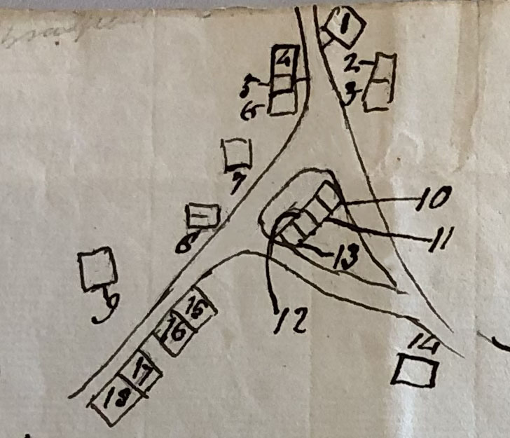
The part of Richard Benyon’s map showing the area of Common Hill around the Bourne bridge is shown right; the River Bourne runs along the top edge. The road from Englefield comes in at bottom right past house number 14 and curves to the right down to the bridge just beyond house number 1.
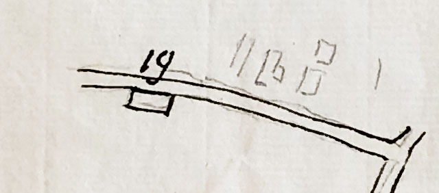
The majority of the buildings are as shown on Ballard’s plan of 1762 but entering from bottom left is the new road down from the junction with the Beenham Lane at the top of the hill and on it are four new houses (15-18). The new road joins the old one at the large “roundabout” with the block of four houses (10-13) in the middle where lived the widows Wilkins and Selwood, Waters, Bushel and Plum.
The key shows that the houses 1-9 are occupied by, respectively: Lambden, William Painter, George Turton, John Cresswell, Thomas Wickens, widow Lucy Simmons, Wheeler, Daniel Bushel and John and Ann Bennet. There is no name against 14 but the new houses 15-18 are occupied by: Thomas and Sarah Painter, David and Sarah Albury, Woodley (a later pencil entry against a blank space) and Painter - this last name crossed through in pencil and Bennet inserted.
Another part of the map shows part of the Beenham Lane from its junction at the top of Common Hill. Along this the buildings of Goff’s Farm are shown in pencil but no details are given and further down the lane on the opposite side is the house, home at this time to someone called Allen. This seems to have been a single house at this time but we know that by 1841 there were two houses, occupied by gamekeepers Thomas Farley and William Cox.
Chalkpit and Hogmoor
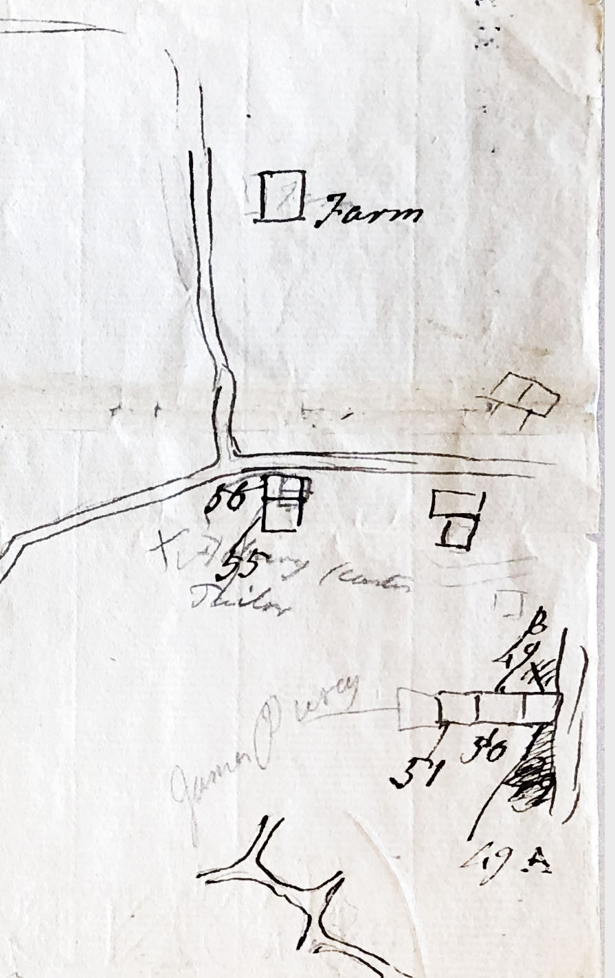
This part of the estate appears to be unchanged from the situation in 1762 with Chalkpit Farm being in existence long before this time, probably before the end of the 17th century. It is shown here with the road from Wimbleton’s coming in at top left and running past the farm to meet the old Tidmarsh Road. At the junction are two houses (55 & 56) that were formerly part of John Horn’s farm and may then have been known as New House. The key to the map does not go beyond 51 and a pencil entry is partially obscured by the number 55 in ink so we have no idea who lived here at this time but John Horn died in 1813 and the farm was sold to Richard Benyon by his heirs in 1819. Further along towards Tidmarsh are two more houses, one on each side of the road. Again there is no indication of who lived here but these were both part of John Horn’s property in 1759 and one or other may have been the house known as Knapps left to his son William.
The other part of the map shows Piper’s Farm homestead with a block of four houses along Piper’s Lane on the land owned by the Rector of Wallingford. The house nearest the road is marked both 49A and 49B with the original 49 scribbled out. Why that should be the case is not known but the key says that Robert and Ann Giles lived at 49. Ann Giles died in 1819 and her name is crossed out with “now Paulin” inserted so perhaps the house was split after that. At 50 was William and Hannah Tegg and at 51 the widow Clark and her son. The fourth house seems to have been forgotten initially and is added, unnumbered, in pencil with the name James Purey or Percy.